Maps of Panama
Panama Maps
Panama is located in Central America. It’s west of Colombia and east of Costa Rica, connecting the two countries with the Isthmus of Panama. The following map depicts Panama’s destinations, national parks, road system, airports, and ferries. It’s handy for planning travel routes or just scoping out the lay of the land. Let us know if you have questions or want help planning your trip to Panama. These maps are provided by our good friends and colleagues from Anywhere Panama.

REGIONAL MAPS OF PANAMA
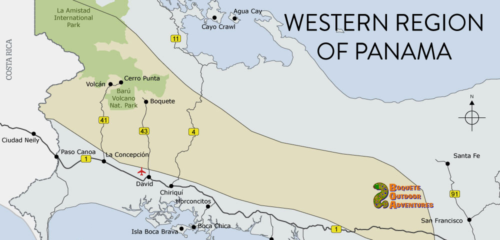
Panama Western Highlands Map
Panama’s western highlands has a large area called the Chiriqui Province. It shares a border with Costa Rica and run east for over a hundred miles. The region includes two mountain ranges, two parks (one national – Volcan Baru- and one international – La Amistad – which is shared with Costa Rica), and several mountain towns. Boquete is the most popular destination, as it provides travelers with easy access to the Barú Volcano National Park, along with some amazing eco-friendly outdoor adventure activities such as hiking, rafting, bird watching, zip lining, and coffee tours. (Map design by Anywhere Panama).
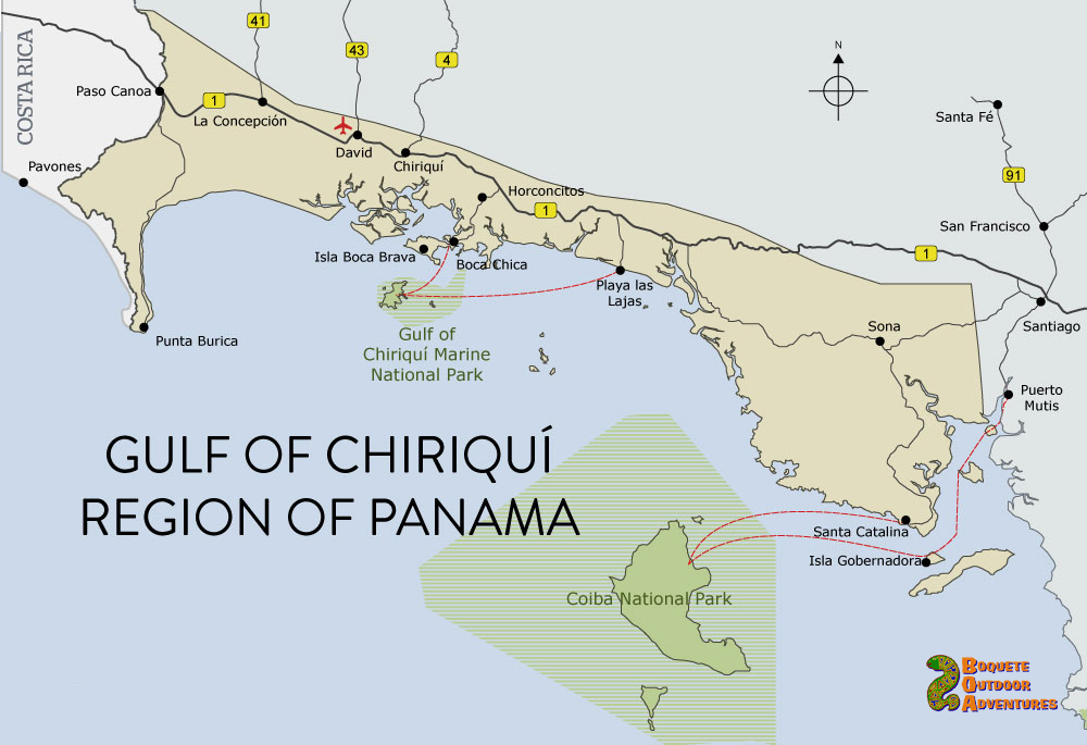
Panama Gulf of Chiriquí Map
The Gulf of Chiriquí region stretches from the western edge of the Azuero Peninsula all the way to the border with Costa Rica, lining the Pacific Ocean coast of Panama. This map highlights popular destinations, including Santa Catalina, Boca Chica, and Isla Boca Brava. This region has two amazing national marine parks which offers protection for a huge amount of marine life. The uninhabited islands offer pristine white sand palm tree fringed beaches and warm aquamarine water, an untouched paradise, and a safe area for migrating humpback whales. (Map design by Anywhere Panama).
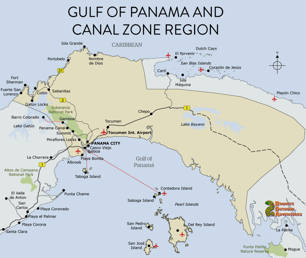
Panama Gulf of Panama and Canal Zone Map
This map covers the Gulf of Panama and Canal Zone region. The most popular destinations are Panama City, the Pearl Islands, and the Panama Canal. Additionally, Gamboa and the Soberanía National Park and Barro Colorado provide awesome opportunities for outdoor excursions. (Map design by Anywhere Panama).
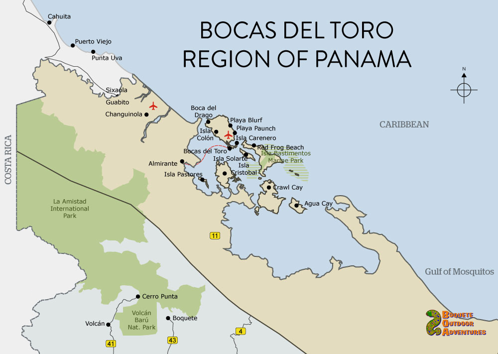
Bocas del Toro Map
Bocas del Toro is a region in northwest Panama. Bocas del Toro modafprovig.com Archipelago is this region’s main attraction for travelers. This archipelago has a scattering of tropical islands, including Isla Colón, Isla Carenero, and Isla Bastimentos. The archipelago’s largest town, Bocas Town, is quite a party-town for backpackers, and close to several good surf spots and white-sand beaches. If you prefer more quiet, visit Isla Bastimentos and the luxurious Red Frog Resort that features Red Frog Beach. (Map design by Anywhere Panama).
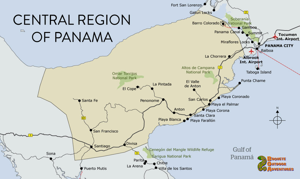
Central Panama Map
Central Panama lies squarely in the middle of the isthmus. Set just west of Panama City, this region has a lovely and accessible coastline — Playa Coronado, Playa Farallón, and Playa Blanca are especially nice. The region’s interior hosts the mellow mountain town of El Valle, as well as two national parks. (Map design by Anywhere Panama).
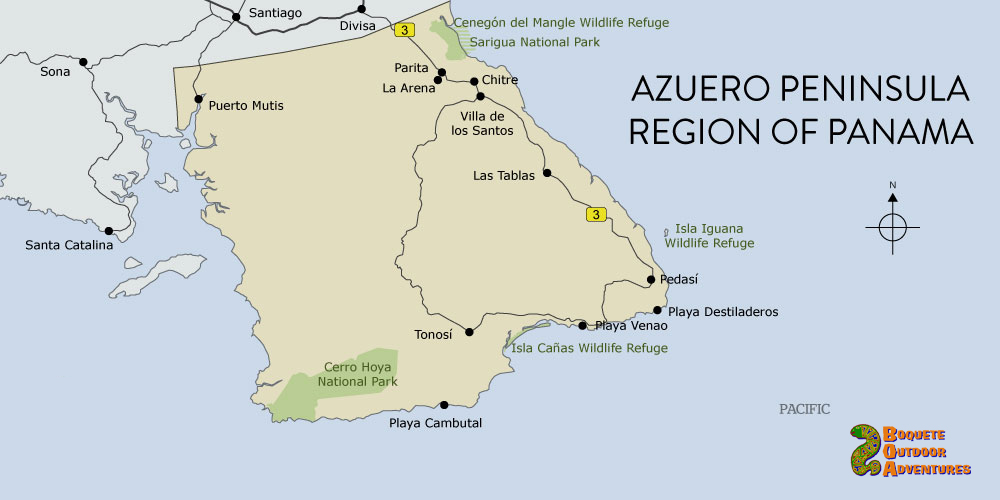
Panama Azuero Peninsula Map
This map highlights some of the most notable towns, beaches, and outdoor areas on the Azuero Peninsula. The Azuero Peninsula lies along Panama’s Pacific coast and is considered by many to be the “heartland” of the country. The large city of Chitré serves as a gateway for much of the peninsula — from here, travelers can head south to visit Pedasí, Playa Venao, or Playa Cambutal. (Map design by Anywhere Panama).
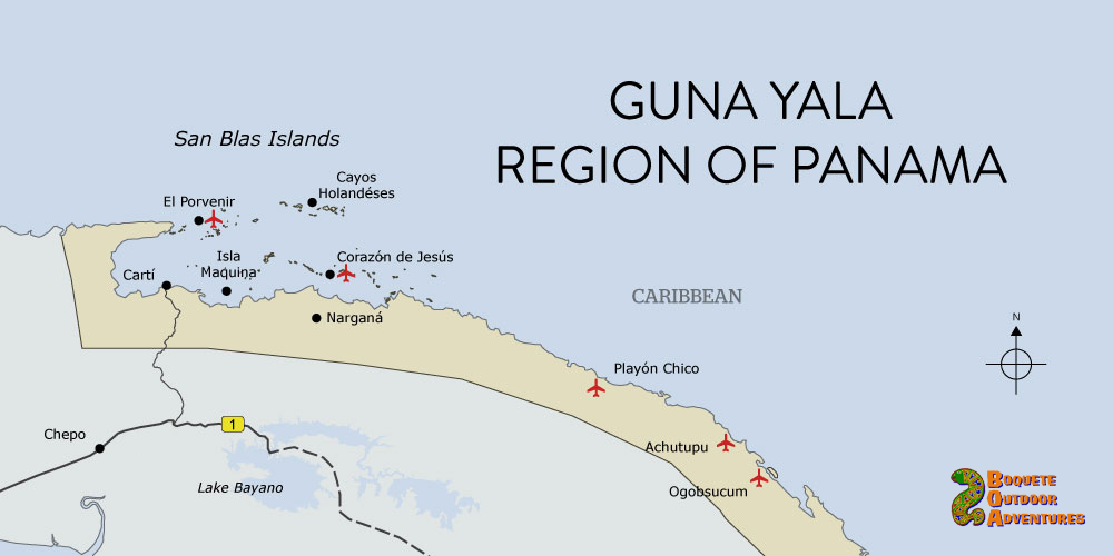
Panama Guna Yala Map
The Guna Yala region of Panama extends along the country’s eastern Caribbean coast. It’s a remote area that’s peppered with islands and indigenous groups. As the map shows, the San Blas archipelago is comprised of over 300 tiny, picture-perfect islands. Most travelers access the islands by either driving to Cartí or flying to El Porvenir. (Map design by Anywhere Panama).
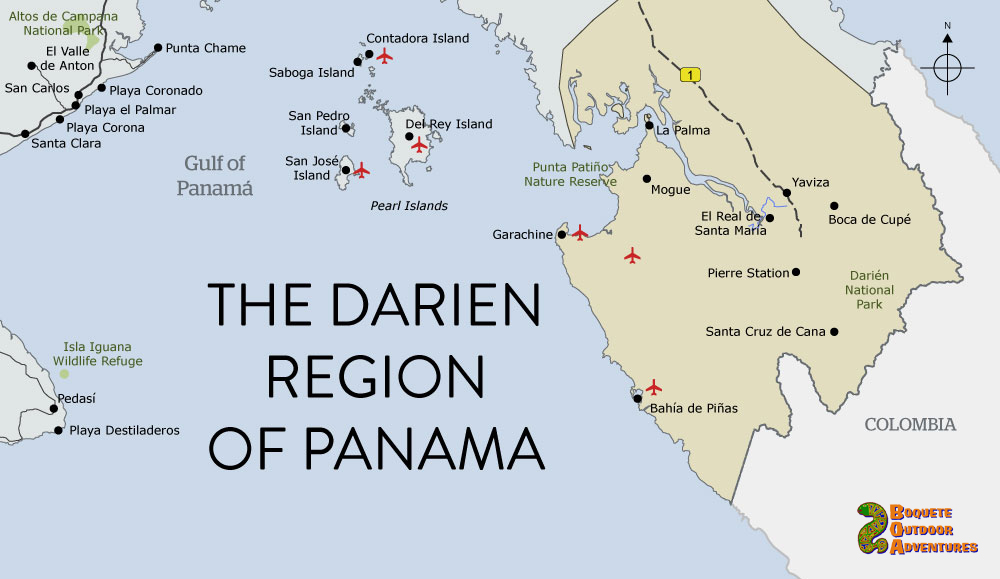
Panama Darién Map
Panama’s Darién region is the largest, wildest, and least inhabited part of the country. This map focuses on places that may appeal to travelers (adventurousness is a prerequisite for visiting the region). Most destinations, like Santa Cruz de Cana and Pirre Station, are remote and totally off-the-grid. Piñas Bay has a small tourism infrastructure and boasts some of the best sport fishing in the world. (Map design by Anywhere Panama).
(Map designs by Anywhere Panama).
Follow Us! 24/7
Recent Trip Photos
We have over 60,000 trip photos from happy customers on our Flickr site. Take a look at what everyone is talking about.